This is a personal account of our recent travels, in 9-1/2 instalments, as written at the time, only lightly edited. Photos added later at home. It’s much for my own record, but some people might like to look through it. Centre, Tanami, Kimberley, Pilbara, west coast, southwest, Nullarbor; 4 June-23 August.
The photos are mostly by my partner Julia Green, some by me. If you click on a picture it will show you a larger version. Try opening in a new window, so you don’t have to re-load the article (ctrl-click on a Mac). Part way through I found a better size-resolution combination for on-screen. Afraid I won’t be revising the earlier ones. Horizon often tilts to right (we both seem to do it). Proves we’re left-leaning.
Instalment 1. 24(?) June. To the Centre
We’re completing 3 weeks away, just about ready to tackle the Tanami Road tomorrow. Shouldn’t be a big drama, but we need to be prepared, as we now are – food, water, extra fuel, spares. We’ll take it easy, probably 4 days for the 1050 km.

First camp, Narrandera


Leaving Port Augusta
2-1/2 days, leisurely pace to Port Augusta (almost), then finally into the dry heartland. I had only vague impressions from 20 years ago, so it was good to see it again, and with new eyes tuned from Outback NSW.
Quite varied at times, though the Stuart Highway, following the watershed, may be the least interesting route. After a bleak saltbush start on the flats around Pt A, we got into some really healthy looking mulga country – good management and good rains I presume. After that there was varied vegetation – often less healthy mulga country, bare saltbush, mixtures. Much of it like NSW, with topography!

Healthy mulga, Stuart Hwy

Island Lagoon, from Stuart Hwy
Good views in the early part, as the Flinders Ranges shrank into the distance, even of a bit of Lake Torrens with water. Other lakes from view points, including Island Lagoon looking as though the “island” was the center of a meteor crater – though not really.
The tent zipper started to fail, so we found a new (cheap) tent in Coober Pedy, unexpectedly. (And not much liking or trusting the new one, yesterday we got #3 in Alice. Hope we’re right for the rest of the trip now.)
Coober Pedy as ugly as I remember. Stopped at The Breakaways nearby, colourful rock strata, including the white stuff that has the opals. A good stop.
Camped at Glendambo, Cadney Park, then off the bitumen just across the NT border on the Mulga Park Road, dirt. Julia a bit unsure, but it worked out well, with a bush camp in the mulga and a short hike up the local rocky hill. Gave us a view of Mt. Connor (first of the “3 tors”, gave us a little fitness training, and taught me I needed proper boots. (Managed to get some in Alice before the Larapinta hikes, and amazingly they worked well.)

Mulga Park Road

Side road, Mulga Park
On to Yulara (decided Curtin Springs is just too far from Uluru/Kata Tjuta). Walked around Uluru (10.5 km) and the longer KT walk (7 km), so our fitness was boosted a little. Both excellent.

Mulga Park camp

Spinifex and red rock

Plains extended, MP Road

Tor 1, Atila, aka Mt Connor

Tor 2, Uluru

Tor 3, Kata Tjuta (many heads)
Also time in the Culture Center near Uluru, but didn’t connect with Vincent Forrester (artist of my big painting at home), though everyone said he was around and might show.
Chill southerly breeze had been following us, and picked up on our last night at Y, but tent survived.
Couple of days in Alice, restocking etc. Visited Desert Park, excellent! Including a nocturnal house.
Then 5 days with our Larapinta Trail tour with our indigenous hosts – Jungala Enterprises. Jungala, wife Colleen, clan “son” Geordie, and “Carroll” (bloke), general camp support and musician extraordinaire from Melbourne. Google him, he’s played with lots.

Larapinta Trail: Wagga Wagga women women, and others.

Geordie (17) and Jungala, tour organiser

Julia & Geoff & Mt Sonder

Home for 5 nights

Camp fire, and dancer

Ah yes, the W MacDonnell Ranges
Carroll entertained us the last two nights. I conjured up my new anthem words – “That’s fucking excellent!” he said. He was inspired to use the two verses to sandwich an anthem in very different style he’d been working on. He knows lots of musos and so my words may start travelling. So it was the best result for me – inspiring others to do their thing.
Five days of walking bits of the Larapinta (8, 10, 13 km or so per day). We covered 50-60 km out of 230-odd. Interspersed with checking bush tucker, getting to know you chats, and little talks about aspects of Culture. Some good insights, and I would have preferred more of that and less walking, but it turns out the women who first booked this tour specified more walking, less culture. Too bad. There was another couple and a young lass, also add-ons. Overall a good group, pretty well matched for fitness, always looking out for each other.
The walks? Well the West Macdonnells are spectacular in their unique way. The bush ranged from spinifex to mulga to mallee to eucalyptus (in the river beds) and casuarina, with scattered other things. Bloodwood was notable. A wasp stimulates a “bush coconut”. There’s a layer of white, edible “coconut”, and inside the female wasp lives as a featureless blob, still producing babies I guess. She’s a delicacy, and Kai (sp?), our German, was game to try. He liked her.
The going ranged from easy to very rough underfoot, up and down but no huge climbs. I decided I was fulfilling my wish to spend time in the arid bush, and probably won’t need to do much more. Julia may give you a different view. Middle day a bit of confusion about timing led to a fast finish on a pretty warm day, so some of us were pretty weary. Next day my energy was low and I struggled a bit to keep plodding. Perhaps just low salts, because after doses of gastrolites (or whatever), the final day I was back to normal and able to enjoy the walking again, to my relief.
Camps were catered, with great food from the lovely Colleen, so luxury in that respect. Some were not too keen on the lack of showers.
So three days recovering and restocking in The Alice, eating out, seeing a couple more galleries and we’re ready for the next stage. Not yet sure what we’ll do in the Kimberley, we haven’t heard from the tour people we hope might fit us in.
Instalment 2. 29 June 2014. Tanami
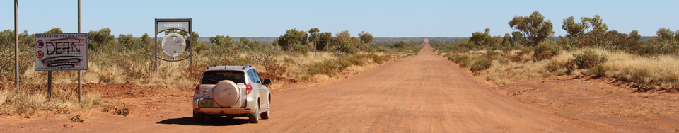
Our journey up the Tanami road went very well, no problems at all, road not too bad, except near the end. As planned we took 4 days.
Day 1 was scenic as we skirted the Macdonnell Ranges on the north side, especially as the bulk of Mt Ziel (highest in NT, 1530 m) emerged in the distance. The country settled into the fairly usual variations – mulga, other low trees, sparse areas, spinifex predominant but plenty of the imported African buffel grass (thanks, cattlemen). Hills gradually subsided. The driving was easy on one lane of bitumen, the odd other vehicle easily negotiated. About half way to Tilmouth (160km) it turned into two lanes. So the first day was easy. Wonderful art piled around at the Tilmouth roadhouse. Couldn’t resist.

Tanami Road

End of bitumen

Dirt

 We fuelled up at Yuendumu for the roughly 600 km stretch with no services ($2.40/litre). Carrying 30 extra litres. We drove right into Yuendumu community, there was no special whitefella refuelling spot as we’d expected. Were directed to the art workshop/gallery, but it was small with little on display and, late-ish in the day the people pretty much ignored us, so we moved on.
Went on and found Mount Doreen homestead ruin to camp. Lovely campsite by a dry creek bed, as described on line. Not described were the cattle, arriving in bands after dark to water at the bore pond nearby. Mumbling, grumbling, bellowing, screeching, occasional sounds of hooves running, there seemed to be a lot to sort out, possibly fuelled by testosterone. Kept up for several hours. Not restful. I wasn’t seriously concerned for our safety, except there was no moon to guide a blundering herd. Didn’t know cattle were nocturnal. Did know that cattle are not very smart, they have crude social interactions and foul their own waterholes, but those impressions were reinforced.
My Dad the farmer reckoned the cattle should be removed from the North (shock, horror). They’re very destructive. We could learn to harvest the native wildlife, if we set about it. It’s been done before, for rather a long time. I agree with my Dad.
Next morning in the quiet it was indeed a lovely campsite, for this dry country. The Tanami “Desert” is not a desert. The only desert in Oz is the Simpson. We were taught in school the rest is “semi-arid”. Correct, with plenty of diverse vegetation, though sparse by other standards. Plenty to eat too, if you know what to look for (and we had learnt a couple of things the previous week).
Day 2. First full day of dirt (started at Yuendumu). I rate most of the road 5 out of 10 for roughness. Occasional patches loose and well corrugated (7-8/10), the odd rocky stretch, but overall nothing remarkable for a dirt road. Wide and plenty of room to pick your path. We made a shorter day of it, through fairly flat land, often the horizon not visible over the mulga or whatever. Stopped for smoko at Renehan’s bore. Entertained the crows, took pics of nice/interesting plants, discarded wire coil, broken bore windmill etc. Can’t remember lunch. Passed The Granites mine (Do NOT enter, do NOT steal our gold, just bugger off!). Looked for camp at Quartz Ridge, with distinctive hill. Found a lovely camp off the road, no sign of a hill, probably past QR (not sure about that either).

Quiet camp, mid-Tanami, beautiful after Cattle Camp

Dingos can’t read
Our silent camp (pigeons, something sounding like a reed warbler but possibly not, in that particular location, you would think), flies, the odd vehicle passing out of sight 200 m away, quiet through the night. Nice bushes, mulga and spinifex sheltering us, but no wind anyway. And at night the wondrous glory … . Lovely. Made up for the Nerandrah camp, first night out, crossroads of the Sturt Highway (Sydney-Adelaide) and Newell Highway (Melbourne-Brisbane), with all-night truck stop nearby. And the cattle. And the roadtrains and other campers on the way to Alice.

Topography! Look carefully.

Ant hills 1

Ant hills 2

Ant hills 3
Day 3. Quiet brekky and off. Rabbit Flat (long closed) we inferred later was the side-road blocked by colourful streamers that we thought might be the local mob’s party venue. As the day progressed we encountered actual topography, in the form of very broad low rises that gave views to the distance. Good for confirming the character of the country. Passed Tanami Mine (Bugger off! Don’t steal our gold!). A leisurely dingo ignored the signs and wandered off towards the mine. The only large wildlife we’d seen. Didn’t mention the dingo that hung around the Larapinta camp. Middle of the night he howled twice to his mates in the distance – just outside our tents. The first time I heard dingos howling it was chilling. This time it was great to hear him close up.
Smoko at roadside with views, trees and bushes with red flowers, diverse low growth, red gravel between, and a frenetic green bee with high-pitched buzz. Lunch later with small trees and more frenetic bees, topography slowly increasing.
WA border, with grand farewell/welcome signs on NT side, one local shire sign on WA side, two broken signs. Bad augury. Later (around turnoff to Balgo community) Julia took over driving (she’s not very experienced at dirt roads and finds them wearing). Just about then road deteriorated badly, to loose gravel heavily corrugated alternating with rocky surface, grade 7-8 on my scale. Wearing. After a while I took the driving back, Julia frazzled. The bad road lasted to Bililuna.

Welcome to WA!

Horse camp, setting up
We camped just short of B along a creek with actual water and much evidence of stock. After previous experience investigated closely and decided it was mostly horse poo. Correct. A couple of families of 3, passing quietly, grazing in the morning, mannerly neighbours. Very nice camp. We were claimed by a family of 3 crows, mum, dad, noisy offspring. They didn’t get satisfaction from us.
Day 4. In the morning I was greeted by the three crows and two fork-tailed kites (the common hawk across the North). The crows said “Where’s breakfast!” The kites said “Is anybody dead yet?” Well, they’re not really vultures.
A short run into Bililuna, 2 km off the road. Petrol $2.60. We could have done the whole stretch from Y on just about one tank. I had added the 10L jerry for a margin. The 20L wasn’t needed. Just about 10L/100km, very good for the conditions. I had been quite uncertain what our fuel consumption might turn out to be.

Junction with Canning Stock Route
Bililuna is an Aboriginal community at the N end of the Canning Stock Route, a track, and favourite of the macho 4WDers, 2000 km from southern WA. So we drove a couple of km on the Canning! So impressive.
After B the road was better. Then we passed a parked grader and it became excellent – the grader had done its job. It slowly degraded and the last part would rate 5-6, a bit rugged. Country starting to change – low hills, some new vegetation. Then we got into low rocky hills and a rocky road. Worth going slowly to avoid sharp rocks.

Wolfe Creek Crater, sans terror
Part way on this stretch is a side road to Wolfe Creek Crater, a well-preserved (relatively recent) meteorite crater, perhaps 300,000 years old. Though I thought I knew enough about such things, it was still impressive – concentric vegetation inside, rim raised about 30 m, few hundred m across. A good diversion despite the 5-7-8 grade road in.
We failed to be terrorised, a la Wolfe Creek, the movie. Real life’s so boring.

Bitumen!
Another hour or so and lo! Bitumen. We were at the end of the Tanami Road. High fives! Pictures! 1050 km, no real problems. At Yuendumu the back door decided not to open. A change from last year, when it wouldn’t close properly. After one stop loading/unloading from the side doors, a pain, we found lifting it got it open. Julia reminds me she had received a message in the night to try lifting – from the ancestors? Next stop – didn’t work. A bit more experimenting and pressing it down got it open. I am now adept at pressing the right spot and popping it open. Whitefella magic. Julia’s impressed.
A short run on the Great Northern Highway to Halls Creek and early into the town campground. Bit of a look around, including the local Aussie Footy match (Sat arvo, per tradition). Couldn’t see a white face on the ground or off. Well, except the ump. Typical. Good to see the locals enjoying something they love, and isn’t bad for them.
Today we came 160 km north to Warmun, home of the (deceased) world-famous artists Rover Thomas and partner Queenie. Early camp and rest. Tomorrow we hope we’ll check out the local gallery/cultural center, and try not to spend too much money. Then a short 60 km return south to a camp near the entrance to Purnululu Nat Park, home of the Bungle Bungles (look them up if you don’t know). Day after we’ll take a day tour in a rugged bus, because the 50 km track in is very rugged. Then follow the bitumen to the west Kimberlies, where we’ll get off the bitumen for some serious scenery, gorges, swimming we hope, and enjoying ourselves.

Julia nirvana

Warmun gallery across Turkey Creek
The country is rocky, with high hills here. Vegetation has changed noticably, rangy things with big broad leaves. And boab trees, fairly plentiful, a few big ones, quite a few smaller (skinny) ones. Good to see them apparently thriving.
Weather – fine, sunny. Meant to say that the Tanami doesn’t seem to do clouds. Kimberley so far has done only a few cirrus in the distance. Temperatures here 5-27. In Alice region 0-18 (could have stayed home for that). Light frost on the tent twice on the Larapinta.
The winter nomad season is in full swing on the bitumen. Huge campers, campgrounds feel like suburbia, doof-doof radios in refuelling vehicles nearby. As the John Williamson song says – strips of rubber, cans of coke, making dust and blowing smoke.
I’m struck by how much up this way depends on one thin strip of bitumen. None of the big campers and little of the tourist industry would be here without it, and a lot of fossil fuels – to import virtually everything. One bloke at the Purnululu camp voluteered “You’re doing it tough mate”, referring to our tent. Not sure what they imagine, the vast majority who shudder at the thought of camping. A bit sad, the level of disconnection from the real world, the story of our time.
Instalment 3, 3 July 2014. East Kimberley. From Fitzroy Crossing.
As planned, we drove 60km back south to a campground outside Purnululu, took the day trip by rugged bus into the Park, then came on to FC.
First though we found the art gallery at Warmun. Afraid some of the kids’ inheritances were spent there. We ended up with one painting each, and could happily have brought half a dozen more home, though we hadn’t really planned to buy. Kind of breathtaking to walk in and see such stuff all around. World famous for a reason. Personal taste as well, but you can see quality when it’s in front of you.
Next day 20 or so of us gathered at 7 am for the ride into and around the Park. No doubt about the quality of the Bungle Bungles either, as spectacle. Individual domes were not quite as large as I had expected, but the number and extent make up for that. Our first walk took in a lookout and Cathedral Gorge, the latter an increasingly narrow gorge culminating in a cathedral space at the bottom of water fall. Surely a very sacred place for the locals. After the catered lunch and another hour’s rough ride we walked into Echidna Chasm, that gets down to about 1 m wide – and still a hundred high.

Purnululu

Cathedral Gorge

Echidna Chasm
The rocks of the BBs are sandstone, but with soft lime cement, so it erodes easily, forming the gorges and domes. Technically, karst structure, usually found in limestone (think Chinese landscape painting with big rock domes – classic examples). Drove in through the Halls Creek Fault Zone, separating 1800 million year stuff from younger to the east – also quite dramatic scenery.
Most of us agreed we’d been smart to leave our own vehicles at the camp. I’d rate the road in as 7-8, with enough creek crossings and steep bits to discourage most casuals – but not all, as our driver explained with some glee the various vehicular misadventures he’d seen, including light campers breaking in two.
Said driver spent as much time on the genius of his boss at making money from tourism (i.e. us) as on the sights around. Big commercial plug. Base camp jointly owned with the local station owner (also a genius apparently). Spent some time explaining how the banning of live cattle shipments to Indonesia had clobbered the already-marginal beef industry. Coles and Woollies won’t take the Brahmin-cross beef they grow (unless they don’t know what they’re getting, nudge nudge, wink wink). So genius station owner is setting up an abbatoir on one of his five or so stations and will ship beef to Singapore Burger King.
Interesting that the northern beef industry was already very marginal before the Indonesian slaughtering scandal that was all over the TV. It would not take much to just stop it, but of course it’s iconic and there is Export Income, so the pollies would never do that.
Driver mentioned along the way that when cattle first arrived here they quickly ate out the dozen or so native species of grass that attracted them in the first place, some to extinction. He said it was due to “overstocking”. Probably true, but I suspect a more accurate take is that cattle are just incompatible with many of the species. Jungala showed us on the Larapinta trail how one kind of native grass is easy to uproot. Cattle curl their tongues around it and pull, uprooting it. Native animals nip it off, leaving it to grow. So in the Centre the brilliant cattle men imported buffel grass from S. Africa (where it is adapted to native cattle), so a feral now pervades much of the continent. Along with native spiky spinifex. I now wonder if spinifex was not so dominant in the old days. So I think it was a key comment – and the story of much of the continent – rush the flocks and herds into the “verdant pastures” and within a decade or so there is ecological collapse to a degraded, much less fertile state. The process is rarely remembered and barely recorded, but Bill Gammage and Bruce Pascoe among others are digging out the old accounts.
Bus driver didn’t have much to say about local indigenous people. The park is jointly managed by Nat Parks and indigenous representatives. And, says Driver, “of course” there are two groups in contention about who are the legitimate traditional custodians. After a century dedicated to exterminating them, perhaps they lost some of their knowledge and stories, and other parts got a bit confused. We hear that back home too. Just beneath the surface of Driver’s comments is the traditional “bloody useless abos” attitude. We passed a couple of places where entry is restricted because of cultural significance. A couple of those gorges were pretty good, too, lamented Driver. We may write an email to his boss, about how people are responding very positively to predominantly indigenous signage and guidance at Uluru. We all get our awareness raised in the process. At the Warmun gallery was a quote of one of its founders, to the effect that their art is their last chance at hanging on to the stories and culture of the land all around them that used to be theirs. If they can get back into managing the park, they’ll retrieve some, and be able to take their young folk there for education and initiation. Some stations in the region are being handed back to the locals, so that’s encouraging too.
Yesterday we came back through Halls Creek, stopping for a bit of restocking and communicating, then 300 km to FC. Encountered another gallery 5 km off the road. Laarri Gallery. More wonderful art, much very colourful. We managed to restrict ourselves to a few small things. Gallery is part of a school and small community, Yiyili. Tidy buildings, local gardens and orchards in process, happy kids, all good to see. One of the returned stations.
Camped at Crossing Inn caravan park in FC. Local watering hole, noisest bar I’ve ever heard (from outside), yelling into the evening, but it calmed down later and we were at the other end of the complex so it didn’t bother us too much. On arrival we were accosted by a self-appointed welcoming host who wanted something (money, a ride, pot?). Not a problem except being far too friendly. All very sad, especially after Yiyili. Probably much healthier if they could get back onto country.
This arvo we’ll be on an indigenous-led cruise along the river through Gieke Gorge. Had hoped then to short-cut up to Windjana Gorge, but the road includes a knee-deep creek crossing, as well as being rough. So we’ll drive much further around – to Derby tomorrow and back to WG the next day, where we’ll camp for 2-3 days. After that some 2-3 day camps at Silent Grove/Bells Gorge and Mt Barnett/Manning Gorge. Gorges (and their water) are a big deal in this dry rugged country.
Which reminds me of an overall impression. We are now in tropical savannah after the semi-desert of the Tanami. Both are fairly harsh. Around here my summary description is rocky and spiky. The politicians and rich people who trumpet the need to “develop the north” ought to be put out here for a week with little to support them. They might think differently. Obviously you can survive in this country – if you have intimate knowledge of water, plants and animals and if you treat them and the land with deep respect and humility. Not the kind of attitude the developers show in any abundance.
Instalment 4. 10 July 2014. West Kimberley
Geike. Took a 2-hour boat ride with an indigenous bloke and one other couple. He’s a character, but did a good job of showing us the amazing rocks, noting fresh-water crocs, and telling us indigenous lore. Pulled in upstream a ways and he made a fire and a cuppa. Explained relationships, skin system, law, inducements, punishments etc and we learnt some more aspects of a complex culture. The gorge rocks are limestone/dolomite of the Devonian Reef, sculpted by the flow of the Fitzroy in flood. Beautiful combination of water sculture and dissolution a la limestone caves. I’ve seen the family pictures but never really understood what I was looking at. Impressive.

Water-sculpted rocks of Gieke Gorge, with local resident

Classic Gieke cliffs

Water-sculpted limestone, Geike
This Devonian Reef fringes the old Kimberley land mass (380 million years ago). It stretches a few hundred km on the southern side, with quite a few gorges etc where creeks and rivers cut through it. It’s not that high (no more than 100 m probably), but with the jagged top of weathered limestone and steep cliffs on the south side. At Gieke it’s only 20-30 m high.

Boab rest stop

Derby mudflats, low tide

Derby mudflats, low tide
Derby. I had hoped we would short-cut from Fitzroy Crossing to Tunnel Creek and Winjana Gorge, but the road was reported quite rough with a knee-deep creek crossing – just enough uncertainty to deter us. So we decided to take the bitumen to Derby and come in from the other end. To save a one-night camp, I offered us a motel night. Ended up in a fairly fancy motel, but it served us well – showers of course, but free internet, laundry etc. So we regrouped and restocked before getting onto the Gibb River Road.

Starting the legendary Gibb River Road into the Kimberley interior

Approaching the Napier Range, aka Devonian reef

In Winjana Gorge

Devonian fossils!
Winjana Gorge. Arrived at Winjana to a pretty full campground. Soon figured out it’s WA school holidays. Lots of kids, bikes, running, etc, but no problem, good to see kids out in the real world. The gorge is fairly spectacular, the reef makes cliffs perhaps 70 m high, and the river winds through it for a few km. We walked a fair bit of it, before deciding on lunch and that we’d probably seen what we were going to see. You do see the transition from outer reef, with steep drop on the ocean side.
Tunnel Creek. We decided to drive the rough 35 km or so in hopes of catching an indigenous tour, complete with the story of Jandamara and his resistance, from his descendant people. We did all that and it was good. However our arrival was disconcerting. It seemed like hundreds of people milling around, including a mass of small motor bikes. A seemingly continuous line of head lamps bobbed into and out of Tunnel Creek (you walk and paddle, it’s fairly easy). Turns out there was a contingent doing a charity ride of GRR on postie bikes, 60-70 of them. Plus a few other groups and single vehicles. Our indigenous group attracted a total of about 7, out of the masses. Better than none I suppose, but a commentary on the state of awareness (notable, because TC is well-known as the lair of Jandamara, who outwitted the white invaders for 3 years).

To Tunnel Creek – livestock, with reef in background

Art near TC, with our good but very quiet guide
Our guide pointed out various rock art and engravings that most were just passing by. He took us out the other end (700 m) and up to another site, where he did his version of Jandamara story, along with bits of culture and bush tucker.
Silent Grove/Bell Gorge. Leaving Winjana in an incidental mini-convoy of 5-6 vehicles, we got back to the main road (GRR) and thought the whole world was there. The postie bikes and their support vehicles and sundry others. There’s a rubbish dumping point there, so several were stopped for that, and so did we. The bikes started ahead of us, so I thought we’d be stuck behind them for a long time. Fortunately they stopped about 15 km down the road and we got past them. Still the GRR was like a parade. For the next 40 min or so we were never out of sight of a vehicle behind or dust from the one ahead. Had to stay slow (and less fuel efficient) to avoid eating too much dust, and to see the road properly, important for rough dirt driving. Eventually it thinned and we got up to speed. Still it seemed crazy for what once was a remote experience. Just glad we had the Tanami behind us, a properly remote experience.

Miluwindi, aka King Leopold Ranges

More Miluwindi
Reached the Kimberley proper (geological sense) bordered by the King Leopold Ranges. Named for Belgian KL II, because he liked explorers. Actually he was a butcher of the worst kind in the Congo. So we especially prefer the local name, Miluwindi.

Dreaded creek crossing

Silent Gorge, upper pool
The road into Silent Grove is fairly rough (7-8) and a couple of creek crossings that hadn’t been mentioned. Not too deep, so no problem. Julia’s becoming an old hand with creek crossings, because Bell Gorge is another 10 km from the camp, and there’s one crossing there too, which we’ve now done twice in each direction.

Lower pool – note person on water

Lower pool, more benign view
The Gorge is pleasant, with an upper, shallow pool and (after a vigorous climb up and over), a big deep pool below the falls. Water is cold, nearly enough to take my breath away. First day the sun was already off the water and I only did a couple of brief plunges. Next day, middle of the day, good sun and a clear view into the water, but still the cold was at my limit. So I felt a bit of a wuss, but too bad. It was certainly refreshing. Bell is supposed by some to be the best of the Kimberley gorges, so we feel like we don’t have to rush around all the dirt roads to catch more of them.

“Silent” grove camp

Culprits

In SG
We have found “Silent” Grove to be a bit less crowded, with fewer giant campers, because of the rough entry. (The corollas don’t seem to have heard the name of the place they like to roost in.) We decided to spend a third day here (a day off), and then to do a day trip about 100 km up to Mt Barnett (to refuel) and Manning Gorge (or at least the pool near the campground). Reportedly the MG camping is crowded, so we’ll return to our site here. Tonight (10 July) SG is also pretty crowded, but not rowdy so far. Saturday 12th we’ll head back to Derby and then on to Broome, to complete our rather strange West Kimberley experience.
12 July. Yes, we did those things. Very much enjoyed a swim yesterday in the pool by Manning campsite. Returned the 7 km to the Mt Barnett roadhouse to refuel to find it was lunchtime rush hour. They weren’t organised enough to separate the food queue from the fuel-paying queue, so the whole thing took 40 mins, and then we had some lunch. A mobbed takeaway in the middle of the GRR? Yes, it’s been a strange experience, far from our expectation in some ways, and especially far from what it must have been like for my parents, around 1970. At Winjana, when I commented to neighbours about the school-holiday crowd, a lady said Perth people either fly to Bali or drive the GRR. So I think we did the GRR with half of Perth.

Further up the GRR – bit rougher

Swimming hole, and rope-pull crossing for walkers

An old giant near the pool. Note small person.
The road to Mt Barnett was distinctly rougher than the earlier parts of GRR, and seemed to be confirming our choice not to chase more gorges over rough dirt. Anyway we penetrated 300 km of the 700 km of the whole GRR. There are probably more spectacular parts, but they were not within our reach. The interior of the Kimberley that we saw is rather flat or undulating, once you’re through the fringing ranges. Surprised me, my picture was of low but rugged country. Coming from the south/west, you first encounter the Napier “range”, the Devonian reef that juts jagged out of the savannah. It’s quite narrow, only a km or two.

“Inside” the Kimberley

Halls Creek Fault Zone
The King Leopold Range is a proper range, rugged, sandstone-capped, a few hundred metres high, 20-30 km through (?). It fringes the southern and eastern Kimberley. I guess the Mitchell Plateau in the north offers more, and the coastline. The Halls Creek Fault Zone that we went through to get to Purnululu was the most striking country we’ve seen, apart from the Bungles themselves, geologically unrelated. I suspect if we’d driven the whole GRR the long middle stretch would not have been so interesting. People highly recommend Mitchell Falls, but that involves the even rougher road north, off the GRR.

Another name we approve of
Today we took our time packing up, and just headed for Derby. Last night there were a few thin clouds, the first real clouds since before Alice. Our larrikin neighbour predicted rain, and we all laughed. This morning the clouds were a little thicker, and it was hazy. I said if it was home it would be a sign of coming rain. As we drove, the high cloud thickened. 50 km from Derby a few spots of rain. I said if it was home this could build into real rain. By Derby it was steady light rain. We almost took a tent site in town, but they didn’t have internet. By then we just said what the heck let’s get a room. Good job. There’s been at least an inch of rain, and it’ll continue into tomorrow probably.

Derby mud flats, high tide and rain

boab still with leaves

A common form of scenery – Derby to Broome

A better form of scenery
So it’s raining in The Dry. We’ve just completed the second major dirt road leg of our trip. We’ve been camping in dusty camps that will now be mud. We feel for the families with kids still out there. The roads may get mucked up if there’s too much, and some of those big rigs might be in strife. Tomorrow the weather map shows the rain going inland – into the Tanami and on to Alice. We might not have got through if it had happened when we came up. So double lucky timing. May it continue!
Instalment 5. 17 July 2014. Broome & beyond.

Pistol Club entrance

Campsite, construction. No camping!
We came on to Broome from wet Derby next day. Ended up in overflow camping at the Pistol Club. Camp “streets” called gunslinger, bullet, etc. Julia has some choice pictures, but we managed to avoid being shot at. Had a good look around Broome. Staircase to the Moon our first two nights – rising full moon reflected off the mudflats and sea at low tide (in Roebuck Bay, to the east of peninsula Broome, for those paying attention). Haze and cloud interfered at bit, but we got the idea.

Low tide

Mid-tide. Note boat ramp in this and next.

High tide
Saw the amazing tidal range – around 9 m at Broome. Saw Cable Beach – yes an impressive beach, even if I didn’t get the urge to stay in a fancy resort and ride a camel.

Point Gantheaume
 Point Gantheaume (?) with lovely stratified coloured rocks. Ate out, restocked, got Julia’s boots repaired and car attended to – no major problems, doing well. Didn’t manage any indigenous tours but enjoyed the time.
Then we heard of forecast strong winds, a fierce storm in Perth, some loose talk by a neighbour camper and we wondered what was going to happen. Turns out heavy rain is forecast for Port Hedland and the Pilbara Friday (tomorrow, and unrelated to Perth). Eventually found wind warnings cancelled for our region and decided to head for Barn Hill Station, only 150 km or so down the coast.

Barn Hill Station & beach – a small selection follows


 Turns out to have a spectacular long beach, with cliffs of red formations, finely layered rocks and blocky cross-bedded sandstone – all weathered into wonderful shapes. Julia the water person is in heaven as we wait out the weather further down the coast. Some cloud here but no rain so far.
The drive down was, I have to say, rather boring. Low vegetation most of the way, but most of it burnt, at least close to the road. Ugly. We’re at an outstation of a cattle run stretching 80 km along the coast and selling live animals via Broome harbour. Wonder what this country could be like?
20 July, Port Hedland
We spent a total of three nights at Barn Hill. The next two days were grey, so the beach views were dulled. My mood went grey too, from the weather uncertainty (difficult to get clear information), the weather (grey with persistently strong breeze threatening to get stronger), and being apparently the only free-standing tent among 150 giant campers. So I didn’t do the photo essay on patterns large and small that the first, sunny, day suggested. We do have some pics to share in due course though.

Surrounded at BHS
Three quirky camps in a row (Broome, Barn Hill, Eighty Mile Beach). At BH it was a large group of dedicated lawn bowlers who apparently come every year for an informal(?) tournament on a two-lane, rather dodgy green. But they seemed to have a lot of fun, in the middle of not quite nowhere.
An evening walk to the beach viewing spot also brought to light 3-inch millipedes, very active, and (Sarah – arachnophobe alert!!) the small bright sparkles of spider eyes. Yes folks, they must have corner reflectors that send the light straight back. Only when your light is close to your eyes (as with a head lamp) will you notice it. Only small grey spiders Sarah, innocently waiting for dinner. Also red moth eyes. I suppose many animals’ eyes reflect like that.
Yesterday we came 200+ km further along this 600 km stretch between Broome and Port H. Julia had wanted to visit Eighty Mile Beach since seeing it on a map as a child. Road in had been closed by the rain, but was open with big puddles. Arrived early arvo, sun shining. Had lunch, headed over the dune for a look.

Looks nice …

Uh oh

Not a happy camper
First view – beautiful ocean and broad beach. Full view – fishermen as far as the eye can see in both directions, spaced a de rigeur 20-30 m apart, many with their 4WDs on the beach, and you had to look both ways to get to the water in a gap among the fishers. Neither of us approve of despoiling beaches with vehicles. Julia’s dream in pieces on the ground (but she didn’t cry). I’ve promised to take her to Ninety Mile Beach. We did see two caught fish, for all their efforts.
At least there were some other tents among the 150-200 campers, and it was very pleasant in the sun. I set up our solar panels ready to face the rising sun and we called it a day. Woke to heavy cloud where the sun should be, rain threatening. Came the next 200+ km to Port H staying just ahead of the weather (on our right, with clear sky visible inland).
Decided suffering wasn’t called for and got a room (so we can send this to you, of course). Weather closed in. Now I see it may continue tomorrow.

Between BHS and 80-mile Beach
 Interesting travelling this stretch. 600 km on the edge of the Great Sandy Desert. Not a desert and not obviously sandy. Low tree vegetation, though much of it burnt (recently or a while back, leaving dead grey bush skeletons with low new growth rising). They need some of the old people to teach them how to burn properly, to cultivate the country instead of degrading it. Tall dead grass (not spinifex) commonly among the small trees and bushes, evidently the cattle don’t like it. Cattle stations thinly spread along the coast. Our maps show no homesteads inland though. So this would be one of the more empty parts of the country (and world). We picked up a book called “You Call It Desert, We Used to Live There”. Will be interesting getting to read it.

Chocolate ground and low hills
The last 50 km or so there was a change – actual rocky hills instead of very broad, low rises, some patches of granite boulders. The sign to me we were entering the geological Pilbara. A granite-greenstone terrain folks, up to 3.5 billion years old, some of the oldest crust left on the planet. The large-scale geological patterns are not like later crust, so my best guess is there was no plate tectonics way back then. What it might have been instead was one of the big debates I have been involved in in the later part of my career. Won’t be resolved any time soon, but fun to work on. Vegetation changed too – more grassy (including spinifex), fewer trees.

Views of Port Hedland


 Also more trucks, train lines, power lines and – still 20-30 km out of PH – more like an industrial zone. Well, one of the bigger mining areas and ports in the world, stands to reason.
I’ve decided that when I come to power CSIRO will have a Division of Indigenous Products, to re-learn and “develop” the many things this savannah country could produce, and stay healthy in the process. Do it properly, instead of the incessant rounds of “Develop the North” idiocies, currently being promoted by Gina and Tony. It’s not European, so don’t try to do European things in it. Native fauna for meat, many kinds of grain to check out, many other kinds of food, fibres and other useful things to explore. If we’d started 50 years ago, we’d probably have quite a few things thriving by now.
We may head inland from here to Karajini NP (Hammersley Ranges). But we also want to get to the Burrup Peninsula, near Karratha, to see some of the million-or-so rock engravings (from up to 30,000 years ago) and other things some of the indigenous locals can apparently show us. Have to double back to do both, and which comes first may depend on the weather.
Instalment 6. 21 July 2014. Karratha, Karajini, Exmouth
Chose to come along the coast to Karratha. Will have to double back nearly to Port Hedland because the more direct road is not good after rain. This way we can exit Karajini to the west, which is more interesting to us because we’ll see more of the inland Pilbara.

Round hills, soft spinifex, gentle rain …
 Interesting 200+ km. Julia called the low hills “persistent” and it’s a good description – never very high, but always some more. Some are smooth hills, others low rocky outcrops, some of dark brown, contrasting with the pale green spinifex we are now seeing again. Between hills the country is often quite flat and treeless. Because the rain was still clearing, the air was moist and mild. The smooth hills and pale green grass gave an impression of a gentle landscape. Total deception – the grass is all spikes and when the summer sun returns it will scorch everything.
26 July Happy Birthday Evan!

The faded sign

Roo, pretty clear


 Morning of 22nd tried to find the rock engravings on the Burrup Peninsula, near Karratha. Look for the faded sign, they said, not mentioning it was lying on the ground. We wondered if it was 30,000 years old too. Eventually found a few engravings. The rock piles are amazing in themselves, random heaps, chocolate red-brown. Plus flowers, trees and spinifex.
Then Julia found a return message from a local indigenous tour guide (Clinton) – end result, we stayed at the local cove and met him at 2 pm. Explained how the sand bars and rocks were exploited as a natural fish trap.

Clinton

Turtle

Emu? Not sure now

Bad guy (near top) – look out

Look carefully, you can see quite a few more
Quite near where we had been looking he showed us a whole lot more, with some stories. Animals near the bottom, ceremonial symbols higher up. Upside-down emu track (like up arrow) – bad spirit nearby. Sure enough, bad spirit engraving around the corner. Keeps away kids who are not ready for some stuff. “Dreamtime” here is called “the time when the world was soft” – so the movements of the giant ancestral beings left their mark on the landscape. Told the story of the bat spirits who misbehaved and some of them were killed in flight – forming the astonishing local piles of chocolate rocks on which the engravings are made. Upright rock near the top of a hill – a burial place (like a headstone).
So we stayed an extra night, this time in Dampier nearby. All night – clang clang, bang bang, whoomp. Presumed it was to do with the iron ore trains being unloaded, but the sounds made no sense. Later heard that the wagons are turned over two at a time to dump their loads on the conveyor belt to the ships, then the machine moves the train and grabs the next two wagons. Didn’t see it, but did see a train on the way south and counted 234 wagons. Ore is a powder, but some of it is coarser we’re told.

Dampier (?) harbour

Gas “processing” plant, surrounded by rock engravings
On the Burrup Peninsular are big natural gas processing plants – where the gas comes in by pipe from the Northwest Shelf. Flash visitors’ centre, but no mention of greenhouse gases.

Road to Chichester, also part of “Warlu Way” that stretches around Pilbara

Yes train

We counted 234 wagons

Someone on Larapinta said its no wonder they invented dot painting

Tantalising glimpses of Hamersley Ranges
Our guide, Clinton, told us the road from Karratha to the national parks was fine, so we decided to do that, saving the big back-tracking nearly to Port Hedland, and also taking us through Millstream-Chichester NP on the way to Karajini NP (in the Hamersley Range proper).

Camp dog on the job

Stargazers camp
Stayed near Millstream in Stargazers Camp, lovely, low key.
Walked to Deep Reach Pool on the Fortescue river. Beautiful long deep pool, also the centre of regional “desert” culture according to Clinton (his Mum’s country). He said originally all aboriginal people were the same, but they became divided and got different languages (I forget why). Intriguing parallel with the scientific history, and also the Tower of Babel. Their culture started at Deep Reach and spread all over the north and west.

Deep Reach pool

Feeding frenzy
His people are part desert, part coastal people, reflecting the rise of the ocean, which forced them to adapt to the coast. The further-out people (flood people?) were drowned and no longer exist. Also reflects scientific history in the TV show First Footprints. When we get to Exmouth etc, they are “real” sea people, not hybrids.

Lovely, but not good for country


Improvising

Um …

While that moves down there, this goes … Possibly an old drill rig.
Went to lookout over the Fortescue, and a short walk around the homestead and millstream. Very pretty, and surely would have been a welcome relief to the original settlers, but unfortunately introduced problem ferals, including date palms and water lillies.
Julia came to call WA “the state of confusion”, because their signage never quite measured up. Oh and some of the old machinery reminded us of scenes on the family farm – my children will understand.
Third day at M-C NP was going to be a rest day, but a cold wind was blowing. We decided to head for Karajini instead, although starting slightly late and with about 300 km to cover, much of it dirt. At a railway crossing there was an option to use the railway road, but you were supposed to have a permit. We went the less direct road, swinging further east. Wondered what we’d done for a while, because it was slow, still some big boggy puddles from rain, washed out gutters, etc, and kept getting narrower. After an hour or so we passed Mount Florence Station, with an option to camp, but decided to press on.

Open country

Better vegetation, Hamersleys beckoning
The country changed as we crested a rise, from open, almost treeless spinifex and sparse bushes (looked lovely, but not up close), to treed with our old friend mulga, not seen since Tanami, and some mallee and other eucalupt, several wattles and other bushes. The road was better too – 70-80 km/hr instead of 50-60. We paralleled the northern front of the Hamersley Range, spectacular layered bluffs.

Asbestos is bad for you

Spectacular – ancient sediments, 2.5 billion years

One-lane highway!

Hamersley Gorge
Got to a T with a road that goes east to Wittenoom – there are signs saying exposure to blue asbestos can cause cancer. Too bad they didn’t tell the miners that, for all those decades. This road (west) was a dirt highway – 90 km/hr or more. Then it turned into the Range and after a little while choked down into a narrow one lane strip winding through a narrow gorge. Amazing transformation. After we came out on a plain there’s a turn to Hamersley Gorge – beautifully folded rocks and a deep pool, though we only looked from the top.

 The Hamersleys are widely spread but often spectacular – easily a match for the West Macdonnells in the Center, but much less known – I couldn’t recall any pictures of what we were seeing. Had to go to Tom Price township to fuel up and get a few supplies. Then, on bitumen, finally headed for Dale’s Gorge campground in southern Karijini, but it was getting late – 4pm, so we had to hustle the 100 km. Some even more spectacular scenery. Unfortunately Julia’s batteries had run down because we were doing too much in one day, but we may be back through for pictures.
Arrived at Dales Gorge 30 mins before sunset – to find a slow queue waiting to be “assigned” a camp spot by the local volunteer gestapo. Weren’t interested in my wish to go pick a suitable site and then register. Took till sunset to find ourselves on, effectively, a gravel road surface that none of our pegs would penetrate – having specifically requested a tent site of course. Managed to secure the tent with a few heavy things in the fading light – and hoped there was no wind in the night. There was not. In fact we woke to a heavy frost and -2 degrees. Turns out Tom Price is at 750 m and we may be a bit higher, not sure. Spent some of the night having the mental arguments that anger brings on, to such little effect.
Next day we cruised the camp and soon found sites that were good for a tent. The ignorant gestapo lady reacted defensively, of course, but did deign to allow us to move. Halleluja. (We would have anyway, might even have squatted in a non-designated spot, but those drastic rebellions were not required.) Took 2 hours to move, so we made this the down day. It’s a very nice campsite among mulgas, the forecast is for more of the same for some days, so tomorrow we’ll being exploring – probably after another frosty night, but the doona is well fluffed.
29 July

Circular Pool, Dayles Gorge

Geometric rocks

Veins of blue asbestos

Didn’t jump

Banded iron formation
Now in Exmouth township. Our second day in Karajini we walked Dales Gorge, took till mid-afternoon. Good walk and striking rocks. On top of the ancient (3.5 billion year) Pilbara rocks are old sediments, a mere 2.4 billion years old, and folded and eroded they form the main part of the Hamersleys, and contain vast amounts of iron. The sediments formed at a critical point in Earth’s history, when the amount of oxygen reached the point of forming insoluble hematite (iron oxide), which proceeded to deposit in huge amounts. Typically it occurs in layers around 1 cm thick, alternating with silicate, making striking red and white bands called banded iron formations. They were very evident in the lower part of the gorge, very flat and broken by vertical cracks at right angles, it’s all very geometric. There’s also a beautiful circular pool, Fortescue Falls (not large but picturesque) and Fern Pool where we had one of our few swims on this trip (cold but swimmable for a while).
Late in the day we drove back some of the way to Tom Price to see if I could get pictures of the ranges – got some but not quite the best.

Conveyors, crushers, sorters, mixers, very big trucks …

The tjukurrpa will not be colonised

Very Big Hole

Dirty corollas, Tom Price town
Next day we took the mine tour. The main pit is 150 m deep, below the lookout, but started 250 m above us on Mt Tom Price, taking out the middle of the mountain. Lots of figures of tonnage, train lengths (236 wagons, 2.5 km) etc etc. Very impressive if you like that sort of thing. Another perspective is that the mountain held particular meaning for the local custodian, now passed on. They didn’t ask him in 1964 or whenever about digging the heart out of his sacred site. Still not a lot of indigenous involvement is my impression, though they’re feeding some royalty funds to projects and land corporations. They now have about a dozen pits, to feed the China appetite.

Not so big, still spectacular

Even smaller …
After the tour we headed west through the southern part of the Hamersleys, camping half way out at a “24 hr rest stop”. Lovely quiet camp near a watercourse. The Hamersleys gradually declined in size, with occasional big lumps, but the tilted resistant strata continued to form varied scenery that I never tired of. Sometimes jagged ridge tops, sometimes sawtooth profiles, sometimes “caterpillar” ridges, sometimes smooth hills softened with the buff and pale green of spinifex against the chocolate red earth – yang and yin hills. Widely separated ridges, sloping sedimentary fans, very spread-out scenery that reminded me a bit of the American West (Nevada and Arizona), though of course that’s very young and the Hamersleys are ancient, so it should be the other way around.

Farmers! Can’t contain their roos!

Approaching NW Cape; that’s not water it’s flat land
And so, eventually, after our roadside camp (with several other parties nearby), we exited the Hamersleys onto flat plains, sometimes with desert dunes, now orange-red like the Centre, few trees. Plenty of burnt patches after we rejoined the main coastal highway. I realised a lot of the interior Hamersleys had not been burnt as much, not sure why, there are cattle all through here. So the bush had been more attractive, adding to the attractiveness of the landscape.
Approaching and driving up Northwest Cape is as flat and uninteresting as anywhere we’ve seen. The town is pleasant, we’ll do a day trip into the national park on the ocean side, where Ningaloo Reef runs down the coast. Probably won’t get out to the reef but are interested to see this bit of the world.
31 July

Exmouth transmissions

North end of Ningaloo Reef out there
Yes, we visited the light house and several bits of beach, with reef evident by breakers offshore. Saw whales in the distance, might have glimpsed turtles close in, and went for a brief swim in beautiful water. The beach is steep, often true up this way, and the waves tow hard in and out so we were wary of getting far into the water. But it was lovely to get bit of beach/water/sun time.
[Note added later: turns out we should have gone into the National Park, the reef is close inshore there. You can’t get everything right.]
Today we came on to Carnarvon. Nearly treeless for much of the way. I don’t like to use the term, but “desolate” is the word that was up for me. Nevertheless the cattle were still evident, along with a few sheep, goats and one emu. One of the very few emus we’ve seen on the whole trip, whereas last year in western NSW they were thick on the ground. We should be eating them.
Knew almost nothing about Carnarvon, but it turns out to have a tropical fruit industry along with prawns and oysters. Real production of good things, as distinct from digging stuff up that’s not good for the world. We managed to get the car serviced after arrival (small miracle) and so will probably move on tomorrow.
Instalment 7. 2 Aug 2014. Carnarvon, Hamelin, Kalbarri, Wildflowers, Perth, Busselton
Spent the morning of 31st (Thurs) in Carnarvon. Replaced a headlight bulb in the car, restocked, visited the local indigenous centre – art and artifacts, plus a fancy display on local history, well done. Weather was lovely and we ate lunch by the water before heading out.

Shark Bay in the distance

Desolate?
Heading for Hamelin Pool at the bottom of Shark Bay. More desolate country, i.e. few trees. Carnarvon strikes me as a very isolated oasis in a very large dry region stretching along this coast. It has no hinterland. Got to a well set up Station Stay campground about 5 pm, in time to put up the tent and join the last part of a raucous happy hour, for a little while, too noisy. Good campsite. This morning we went nearby to see the stromatolites – small rocky columns formed by microbial mats in the hypersaline water (twice as saline as normal sea water).
I’ve been hearing about stromatolites for a long time from my geology colleagues. They are some of the earliest clear evidence of life on Earth, 3.5 billion years ago. Shark Bay is one of the few places where they still survive. There’s a board walk so you can walk out over them without harming them.


 The information boards explain the microbial mats contain thousands of species of microbes, forming a complex ecosystem. The key microbes are cyanobacteria (aka blue-green algae), which photosynthesise (they’re the ones that spent 2 billion years or so generating enough oxygen to change the planet, and precipitate all that iron ore). The many other microbes then live with and off the cyanobacteria, of which there are over 50 species. It’s all rather unimpressive to look at – columns in the water up to half a meter high and 20 cm across, with slightly cauliflower tops.
But there are *thousands* of *species* of microbes, just in this one small ecosystem. To me it’s amazing, and it says important things – there is incredible diversity of life on this planet, especially at the small end. There is an invisible base of microbes that came first, and that still support all the other forms of life. Our own bodies would not function without them. Those who think the Earth is just there to be used, conquered, etc are oblivious to the deep truth of their own existence. The Abbotts of the world destroy profound things in utter ignorance of their own folly. Some day we will learn again that we are only part of something much bigger, and we must behave accordingly, or we don’t survive, it’s as simple as that.
We decided not to see more of Shark Bay, as we don’t want to swim with dolphins and it would have taken a fair bit of driving (100 km each way) to see more sand, sea, etc. We’re not into doing everything. So we came on.

Vegetation!

Trees! Canola!
After a while we noticed the vegetation was better, large bushes, some mulga, getting thicker as we came. Then trees! I felt some relief. Mulga and mallee, but also larger eucalyptus, casuarinas, even some native pine, kurrajong (I think) and big banksias. Lots of variety evident in the bushes etc even if I couldn’t identify many. Also starting to see lots of flowers, we thought we might be a bit early. A while later – paddocks, wheat fields, civilisation! We’re about 100 km north of Geraldton, near the northern limit of agriculture.
I had been told Kalbarri National Park was good. So we came in, finding coastal heath land and, finally, the small holiday town of Kalbarri at the mouth of the Murchison River. Pleasant, not too remarkable. Good cliff-top coastline that we’ll see tomorrow on the way through. If I remember correctly, the NP is partly to preserve some of the biodiversity that is a feature of this SW corner of the continent – one of the “biodiversity hotspots” of the world.
It was windy and getting worse, so we upgraded from a tent site to a “backpackers’ cabin”. We’ve decided this is the way we’ll do the cold windy part of the trip we’re coming into, when necessary. Cheap and quite adequate.
6 Aug

Looking back over Kalbarri town

Kalbarri coast
The cliff-top drive south from Kalbarri town is quite spectacular, and we took some time to visit the various lookouts, several hundred feet high looking down into beautifully clear deep water, well worth it. Once past the cliffs we travelled through attractive coastal farmland, until we came to – a pink lake! More micro-organisms, didn’t really get the story, apart from their Latin names.
Geraldton is quite a large town, now with proper hinterland, industry, etc. We only stopped to communicate with friends in Perth about rendezvousing with them. Turned out they preferred we visit them Tuesday (this being Sunday), which gave us a day to fill in. We turned inland to look for wildflower country, missed a turn to the recommended town of Mingenew, and ended up in Mullewa.

Onto the plateau, wheat, canola
 On the way we climbed onto the inland plateau a few hundred meters high, and for a while were treated to vast views by the large, very broad undulations, 5-10 km peak to peak and probably a couple hundred meters high. Haven’t seen that sort of topography in Oz, as I recall. What we were viewing was also remarkable – huge “paddocks” of wheat and flowering canola. One I could see would have been the best part of a km across, and stretched along the road probably 2-3 km. This, clearly, was not family farming, it was agribusiness doing what it does best – massive monocultures. No wonder there’s a problem with soil and salinity in the WA wheat belt. So, deep green and bright yellow as far as the eye could see (very patriotic), with thin lines and odd patches of remnant “scrub”, the highly diverse native bush.
Mullewa had a quirky little campground being extended, and you booked in at the Ampol back in town, then grabbed a bit of grass for the tent. Worked well as it turned out. The night featured the largest, longest chorus of dogs either of us can recall, a dozen or twenty voices from highest yip to deepest woof, all frantic. We’ll never know if there really was anything to bark at, but they kept setting each other off, so they lasted a long time, probably most of the night. The penny dropped the next morning as we explored a tiny town in fairly hard times and mostly aboriginal. I’m afraid it’s probably a culture of letting camp dogs do their thing, fine when it was dingos because they are very independent, don’t bark, only howl, and that not incessantly. When I learnt that about dingos I wanted them bred into all the town dogs in the country. My desire is strengthened!


 Next morning we learnt there is a wildflower walk of 2 km or so right across from the campground, so we spent an hour doing it. Carpets of white and yellow pompoms and everlastings, pink things, and many individual plants and bushes, so we got a good dose of early wildflower season, lovely.
The local information centre shouting lady (they all seem to do that, we must look stupid and deaf) gave us a map with other localities marked and we set off on the wildflower trail. We saw many good flowers on the roadside, sandwiched by the wheat and canola, but struggled to find the localities allegedly with special things.

“War Rock” display – also a water storage rock
Did one vain loop trying to short cut, as time was running low, and found “War Rock”, with information signs. We thought, oh, they’re acknowledging the black-white conflict, how enlightened. No, they marked a place of an alleged black-black “war”. To their credit they quoted a local elder saying it would have been a ritualised sorting out of disputes, perhaps over resources or women – justice being meted out according to the Law, and not a war.

T1 returns!
So we gave up on the special places, passed through Morawa and camped in Perenjori. I decreed it was time to return to Tent 1 (T1). It really is roomier, and better. Good town camp with caretakers only some days of the week. We didn’t have the $15 in the right cash and I insisted I was not going to visit the shire office, so we skipped (don’t tell).
So we proceeded to Perth, about 350 km, a fairly long day for us, especially as our friends now live near Fremantle so we had to traverse much of the city. Nearer to Perth we were in the rolling hills of the Darling “Range”, very pretty farmland, proper farmland instead of agribusiness, good to see. Anyway we made it with no mishaps and only moderate frustration. (Julia calls WA the state of confusion, because they don’t seem to know how to do signs so you know in advance what’s happening.) This is our only encounter with big city for the whole trip and we had hoped to avoid it, as it was a culture shock after two months of remote roads. Anyway we survived and had a lovely visit.
This morning wandered our way south out of Perth, visiting some Freo docklands, getting lost in waterfront developments, but eventually reaching coastal Lake Clifton where there are *thrombolites*. My new word for the day. They are examples of *microbialites*, my new word from Shark Bay. White rocky domes growing in fresh water, created by our friends the cyanobacteria, but this time with different-looking results, presumably with different species. Relatives of stromatolites, which grow in hypersaline conditions.

Lake Clifton

Thrombolites
After the city and expressway traffic, the short drive and short walk to the lake were wonderfully refreshing. A beautiful day, fragrant bush opening onto a peaceful lake of clear water, rippling and sparkling. Ah, peace.
The drive further south was mostly through picturesque farmland with *big* old gum trees plentiful along the road. Driving got a bit frenetic as we passed Bunbury and came on to Busselton, where we are in a cabin.
Turns out there’s a species of eucalyptus that grows along this coast called Tuart (never heard of it before) that has some of the hardest, highest-quality wood in the world, whose natural oils prevent metal (bolts, hinges etc) from rusting. So it was heavily logged and they’re struggling to revive the remnant small areas of them. There’s a reserve nearby. Don’t know if that’s what we were seeing on roadsides.
7 Aug

Flashest dunny in the West

Coast between the Capes – near Gracetown?
One of our shortest travel days, might have made 100 km. We’re now in a tiny dot called Gracetown on the “two capes” road (Naturaliste and Leeuwin), behind Margaret River. We took our time seeing nice beaches, Cape Naturaliste, nice bush and passed through a lot of wine country. Didn’t see the underwater observatory at Busselton jetty, it was closed, too bad. It took some time later to locate an Aboriginal culture center, but eventually did, and a ceramic artist recommended to us in Perth.
One observation I have meant to make is that as we have come south everything has become more familiar again. The southwest is much like the southeast, more than I expected. Some of the species are different, but the bush looks very similar to around Portland, including grass trees, and many familiar birds have re-appeared to us – maggies, kookas tonight (first time), wattle birds etc. And our familiar woebegone crows (Australian raven). The ones up north are Torresian crows, my bird book says, and they just go “Kark”. No fun at all. And it’s lovely to be in the wintergreen, with real grass on the roadsides. Of course we’re seeing it at its wettest, the rain here is highly seasonal, the reverse of up north.
Instalment 8. 9 Aug 2014. Southern WA
Yesterday and today we came through big tree country, arriving in Albany this afternoon, across the southern-most bit of WA, and the wettest (48” was noted at one place). Having seen near-90 m mountain ash (eucalyptus regnans) and coast redwood (sequoia sempervirens), I was keen to see karri (eucalyptus diversicolour) that get about as tall.

Ooh it’s big


The tallest we saw, I think
Yesterday we got to Shannon Nat Park, recommended, and with a 40 km loop drive through the forest. Did the northern part after we arrived and set up camp. Some good sections and tall trees, but not all I had hoped for. This morning we did the southern loop, including “big tree grove”, and that did meet my hopes – enough in one place to get some sense of a forest of big trees, though this is “old growth”, not virgin. Beautiful smooth-bark eucalyptus with clean straight trunks for 2/3 of their height, then branching into a crown, said there to be over 80 m tall (270 ft) and perhaps 300 years old (some reach 90 m and 400 years). Similar to the mountain ash back east.
Camped at the site of an old logging village, in deep forest, quiet and beautiful, hardly anyone there. This morning was 7 degrees, but without sun it felt colder than the zeros with sun we’d had in the Centre. Days have been about 15, but not much wind. Today however there have been showers.

Tingle – with character


Look closely, lower right


Karri and Tingle
The surprise for us was today. We had seen mention of “tingle trees”, never heard the term. Turns out they are a local species (eucalyptus jacksonii), occurring only along the wettest part of this southern coast. They are not as tall as karri but massive. The champ has a girth of 25 m because of massive buttressing near the base. But they are big trees, often 2-3 m through, 40-60 m tall, the most massive of all the eucalyptus. They don’t rival the giant mountain sequoias (sequoia giganteum; nothing does), but they’re still impressive trees, and who’s ever heard of them?

Vertigo anyone?

 In the “valley of the giants” there is also a treetop walk, which we did – in the heaviest rain of the day. Metal poles and long spans reaching 40 m above the hillside, among the canopy of some of the tingle trees. I’m pretty good with heights, but the slight wobble of the spans, the artificiality of the setup, and the rain had me a bit uncomfortable. Julia was more challenged but controlled her fear and did it too. It was a long way down, with only a grill underfoot and some rails, she did well. So we got up close and personal with those big trees in their favourite environment – lots of rain.
I visited some big mountain ash in Victoria some years ago, near Marysville (don’t know what the 2009 fires might have done to them). We had to search for them, there was little or no signage. It wasn’t easy to find a good grove of karri here either, for all their fame, and the tingles we’d never heard of. We Aussies don’t seem to value these things. Americans, for all that they exploit everything in sight, managed to preserve a stand of 90 m coast redwoods at Muir Woods quite near San Francisco, and the tallest stand of trees in the world, up to 115 m, in Humbolt County to the north. A website says mountain ash have reached 101 m, but there’s fairly reliable evidence that a mountain ash was measured *after* it was cut down at 375 feet (112 m), right up there with the tallest coast redwoods. I’ve heard the Canadians cut down a comparable douglas fir too. Smart.
The big trees are not simply a contest for me. They are a measure of what the Earth can be, and what we’re doing to it. Is there *any* virgin forest of any note left in Australia? If there is I don’t know about it. Why couldn’t we leave just a bit? Why, still, do our “leaders” still speak only of what can be “developed”? It’s not just tall trees, the whole country is degraded from its state in 1788, something that’s been clearly evident to me almost everywhere we’ve travelled. Yes, there are marvellous places, but we can’t see all the marvels there used to be. Will our children see even fewer? It takes hundreds of years to grow a big eucalyptus, perhaps 2000 years to grow a really big redwood. Will our direct actions and our inadvertent actions (mainly increasingly destructive bushfires) permit them to grow?
11 Aug

Outer bay – King Somebody Sound?


Outer and inner harbours
We spent yesterday in Albany. We marvelled at the coastal bluffs, big southern ocean swells rolling in, sparkling water in the huge triple bay on a bright blue day. I had a vague idea of granite bluffs, but now my picture is filled out dramatically.
The town has kept a fair bit of its small-town character too, the main street still has real shops. The big boxes are up the road a bit. Even got to a market on Sunday morning, complete with music from “Limerick” quartet. I spoke briefly to them, they know of the Wises, Lucy and String Contingent (muso mates of Evan and Sarah). Didn’t establish any more direct connections.


Beautiful farmland – and a generation of old trees gone


Brave Julia – it was a fair challenge
This morning we travelled 40 km north through lush farmland to the Porongurup Range, granite tors sticking up dramatically. We did a 2-hour walk to a “granite skywalk” – they’ve installed metal holds, a ladder and a walkway up and around the crowning granite boulders of a local peak. Great walk up through the bush, then another test of our vertigo, which we passed with flying colours. Spectacular views. We needed the exercise after a lot of driving lately, and a lot more to come soon.

Stirling Range

 Another 40 km north and we passed through the Stirling Range, an even more abrupt and ragged range, this time of tilted sedimentary strata. I was reminded a lot of the Grampians. We didn’t climb them, because we wanted to press on to a camp in the wheat-belt metropolis of Jerramungup, so we’re in comfortable range of Esperance tomorrow. North of the Stirlings the country changed from pasture, cows and sheep, to wheat, canola and some fallow. No more big trees, often not even medium trees. Only a hundred km inland and the rainfall evidently has faded a lot.
13 Aug
Came on to Esperance yesterday, arriving early arvo. The country alternated between wheat/canola and increasingly small scrub.
Soon found the local aboriginal culture centre in town, with bright and chatty owner. Been running it for 11(?) years. She and “hubby” run tours as well, and they’re intending to ramp those up. We didn’t have time to take any. Decided to check out the nearby Cape Le Grand National Park. Found a lovely camp site well sheltered from the stiff breeze, and decided to stay. Today we decided to stay a second night, lulled by the sound of surf a hundred meters away, in a beautiful spot separated from the camper vehicles.


Many islands out there

Pick up your feet please
 The Park stretches along the coast E of Esperance, with many granite domes dotting the landscape – and seascape, many islands out there. Once were hills, I’m sure the locals would have stories from the time the water rose, a mere 11,000 years ago. Bragging the whitest beaches in the universe, we can’t disagree they’re white and beautiful, running into brilliant turquoise water. We’ve had a fair bit of sun, so it’s all been spectacular. This morning we took the one-hour walk over hills and view points to the next bay. Very good walk.
Tomorrow we’ll do a bit of shopping back in Esperance, then start the serious business of driving east. 5-6 days to Port Augusta? It’s been good to stop and be washed by sun, breeze and the sound of the ocean, I feel like I’ve been cleansed and relaxed.
One observation about the west I’ve been meaning to mention, the windbreaks and ornamental trees on roadsides etc, and even in towns, are mostly native. Not the pine trees and deciduous exotics that are much more prominent in the east. Given the variety and attractiveness of them, it’s refreshing, and I give a big plus to the sand gropers.
I should also mention the many national parks along the southern bit, many of them adjoining, so that large chunks of forest country are now preserved. Not only has the Greens party had a strong base in WA, but there is a Liberals for forests faction as well. Good on them. They’ve done well against the miners and the entrenched corruption that must be the equal of NSW (and all the others?).
This is probably stale, but many of the towns in southern WA end in “up”, from the local Noongar for “place”. Hence Porongurup, Jerramungup and many more. We’ve also encountered some lesser known ones. Bellyup. Buggerup. Stickemup. Chewemup. Cheerup. And so on. I expect the sand gropers tired of this game long ago.
Instalment 9, the last?. 15 Aug 2014. Nullarbor
“The Nullarbor” (Plain). For those overseas, or those who managed to sleep through their entire school experience: null = none, arbor = tree, no trees.
The surprise has been – trees! Norseman, the start of the Eyre Highway, is about 200 km north of Esperance, and yesterday for the last 70 km or so (after the wheat and canola petered out) we were in beautiful woodland, at times verging on open forest. It’s not really part of the Nullarbor, but it’s on the way to Kalgoorlie which I understand to be arid, and I expected the same at Norseman I suppose. The Eyre Highway extends about 1700 km, Norseman to Port Augusta.

Eyre Hwy begins

Real trees

Healthy bush
The woodland continued this morning beyond Balladonia, about 200 km east of Norseman. Some of the best country we’ve seen on the whole trip, in terms of health. And real trees, some quite tall, along with the shorter mallee type (multiple trunks from an underground “lignotuber”). A basic test of health is the top foliage, which is thick and fresh, with no bare branches rising above it, the signature of fire. Fire, of course, is natural, and was also used intensively by the aborigines, but they were careful to keep the fires from being so intense as to damage the trees (or dominant growth), and to burn in patches, so wild fires would not travel far.
Inevitably we saw patches that had suffered intense fire recently enough for the “canopy” to be dead branches; that might have been many years ago, if this stuff grows slowly. These patches might have comprised 20% or more I suppose, but that’s better than much of the country we’ve come through (50% or more), and I found it very refreshing to drive considerable distances without the reminder of our ignorant mismanagement. The wet forests of the south that we’ve just been through are often beautiful, but they have been disturbed by logging, possibly diseases (from the logging disturbance) and some fire too I expect, and a lot of it looked like regrowth (many young trees rather than the fewer, larger, dominant trees of a mature forest).

A bit of null arbor

Then some scattered trees again
Anyway, through a large area around Norseman there are quite tall trees mixed with small trees, large and small bushes and shrubs, the kind of fairly complete growth you don’t see if it’s eaten out by cattle. A pleasure to travel through. After Balladonia it thinned out, and patches with few or no trees became more common. We have come another 350 km through Caiguna and Cocklebiddy to Madura (longish day for us, 550 km). At times there were few trees, but then small trees/large bushes would reappear. The last while before Madura it returned to proper trees. Madura sits at the base of a long escarpment that drops by perhaps 50-70 m, and the plain ahead has trees that are more scattered, a different sort of country.
I found yesterday I was not looking forward to this drive. A bit surprising, as it’s iconic, but we’ve already seen a lot of “null arbor” country (in the northwest down nearly to Geraldton). Also I supposed we’d be camping in designated campgrounds or staying in cabins, especially if it was windy, and I’m really over campgrounds. Finally we have to plan for the border gestapo who confiscate all fruit and vegies (I mean to ask them how much agriculture occurs between us and Ceduna, where farming resumes, and they have another check point). So it felt like all the novelty and fun were gone. It’s so much more civilised than when my family did it, now it’s another strip of bitumen.

Lovely bush camp

As we approached Norseman yesterday we realised there was good bush around us, and no wind to speak of. We found a nice spot off the highway in the bush and made a lovely bush camp, no nazis, no barking dogs, no bellowing cattle, no camp generators, no blazing lights, not hemmed in by big campers, no drinking parties into the night, no peg-resistant hard gravel, the kind of camping we haven’t done enough of. Earlyish in the night there was an unmistakable pitter-patter on the tent, which continued on and off through the night but didn’t get heavier. So we packed the tent in a lull this morning and ate a *huge* breakfast at a Norseman truck stop, and all was well.
We kept pace with the light rain patches most of the day, so tonight we’re in a motel room (NO cabins! NO camp kitchen! NO cooking in the rooms! Oh dear, another nazi), but we’ve showered, had a lovely meal and WE aren’t nazis about camping! We do hope to find more nice bush camps along the way, weather permitting. Many of the rest stops have tracks leading off where others have clearly done the same.
17 Aug. Happy anniversary Judy & Kevin!
Now in Ceduna, the Nullarbor behind us. We did get a good bush camp last night, behind a rest stop (#588, 81k peg; note to ourselves) midway between the SA border and Nullarbor road house, i.e. in the middle of the Nullarbor – well sheltered by a patch of low trees and thick bushes. But we didn’t need shelter as the weather was calm and beautiful, though on the cool side, 16 by day and a heavy dew by night, which was well frozen in the morning! Right next to the ocean! But the sun warmed us fairly soon.

Dropping off plateau at Madura

Scattered myall on lower land

The long escarpment
 So, going back a bit, after dropping off the plateau at Madura, yesterday morning we followed below its escarpment for nearly 200 km. Remarkably continuous and uniform in height and form, must be one of the more notable escarpments around, flat land above, a drop where the old sea shore was in the Miocene (20 million years or so ago, as I recall; no Sarah, not from personal experience, rather older than the pyramids), and flat land below. Trees on and near the escarpment, scattered myall (an acacia) further away. Dry country but looking healthy, though (inevitably?) there’s the odd cattle station. I was puzzled though, because there are supposed to be sea cliffs along the Nullarbor, but we had dropped down.

Approaching Eucla, and seacliffs


Telegraph station

Mystery solved at Eucla, where we climbed back on to the plateau as the escarpment rejoined the coast. We dallied near Eucla at the old telegraph station, now half buried by sand dune. Must compare with Dad’s photos from 1965! The old gum trees still thrive, up to their thighs in sand, but the building is roofless and graffitied, though standing well and revealing the hand-scraped limestone bricks.
Being a water baby, Julia had to reach the sea, though it was about a kilometre walk away. So we changed into hats and sandals and did that, dipping toes in the waters of the Bight, viewing big piles of seaweed, and the remains of an old jetty, obviously for the supply of the telegraph station. Now well used by sea birds. Almost no swell, remarkable for the Southern Ocean in winter.

Well, she asked for it

Whitefella midden
On the way we passed a whitefella midden. Broken brown bottles and sand in a big pile. Such a charming culture. Had to watch where we stepped.
And so on from Eucla. First stop the WA/SA border – and the vegie nazis didn’t require us to stop! Another speech about stupid white men that I was unable to deliver. We’ll meet them again at Ceduna, a more sensible place.


OK, OK, no trees!

Edge of the world just over there


Absorbing limestone make nullus arbor
The plateau featured the now fairly low vegetation, though with small trees still in patches. It all looked very healthy by my criteria mentioned earlier. The plateau also features views of the sea cliffs, 80-100 m high and everything they have been touted as, quite spectacular. The flat land just ends, dropping into the flat ocean. The edge of the world. The strata of limestone well visible, brownish, then white, then brownish again (those are technical geology terms), the same at each stop. We looked for whales too, but saw none.
Wondering where and whether we might camp in the sparsely vegetated terrain, we saw a rest stop ahead, stopped to check, and found the camp site described above, lovely.

Lovely camp


Stunning
After this morning’s chilly start we saw two more cliff views. The first must have been a fairly uncommon sight, a view east of about eight headlands in a row, with morning sunlight beams slanting through the sea mist under a beautiful clear blue sky. In August! Yes we have pictures and I’ll endeavour to post something when next I get internet.


Leaving the roadhouse – where do they hide?
The road turns away from the cliffs and the vegetation dropped to literal null arbor, for perhaps 50-70 km, with the Nullarbor roadhouse somewhere along there. OK, I said, I concede, there really are no trees in the real Nullarbor. The highest vegetation 1-2 feet high.

Whale and calf

Dunes, Head of Bight

Desert garden
A bit past Nullarbor roadhouse is a side road back to the coast (only 12 km) to “head of the Bight”, the northernmost swing of the coast. Also touted for whale watching. You pay an entry fee to get on the viewing platforms, which I bridled at, until they confirmed that it’s run on behalf of the local Yalata people, whose land we were on. I can’t ever raise any objection to blackfellas soaking whitefellas. Happy to give them some income. Anyway there were whales aplenty, a dozen or more easily visible, and some fairly close in. So we had a good look. This is also the easternmost point of the cliffs, which give way to beach and huge sand dunes, which we were not close to but which are spectacular, perhaps 80 m high themselves. So a dramatic finale of the Nullarbor coast.
We had seen a sign, before Nullarbor roadhouse, proclaiming the western edge of the real treeless plain. This puzzled us as we had been seeing only sparse trees since Eucla at least (200km behind). Back on the highway, and the funny thing was – not too far further along we saw trees ahead – and they continued. We were in open woodland, not just scattered small stuff. A bit later and there were open patches looking suspiciously like cleared land. By this time we were out of the Yalata country. Then – green – wheat – civilisation. So the sign made no sense, even if they got the wrong edge. And we were through the Nullarbor, though still well up the Bight and still more than 500 km from Port Augusta.
The Nullarbor (or the Eyre Highway), we can now say, varies from open woodland through low scrubland to stretches of largely treeless shrubs, with the longest such stretch near this end and extending for perhaps 50-70 km. Interesting that the Hay Plain is treeless for longer, I think, and so were parts of the drive down the West. But the Nullarbor has it’s own character and features, whatever it happens to be called, partly by historical accident. And from Norseman to the beginning of farming at this end, the vegetation looks very healthy. In fact after the 200 km or so Norseman to Balladonia there was no obvious sign at all of fire or other degradation, at least to my inexpert eyes as we whizzed by. Refreshing to see.
So on through agricultural land, we realised that there were more nearly-treeless stretches, though green. Julia dubbed them nullarbor farms – broadacre wheat, as we had also seen in WA.
We checked a couple of potential camp sites, and they were duds, little cover, too close to the road, so we came on to Ceduna. We are now ensconced in a luxurious retro-50s “cabin”, complete with totally sagged couch, but cheap and fine (so long as we sleep well). We feel the main event is now over, and we’ll head for home over the next few days.
Oh and we were well prepared for the vegie nazi, showed him our fruitless, vegie-less car fridge and he waved us on. I certainly don’t object on principle, but they could be more sensible about it, and give clearer warnings well in advance.
So my fears came to naught and the trip across the Nullarbor was excellent and memorable.
Well, there were the trucks roaring by 50 m from our tent last night. It was still, and the country was flat, so you could hear them for at least a minute before and after. There were only brief lulls when you couldn’t hear any. I estimated, while waiting a fair while for sleep to come, that if there was one every 5 km for 2000 km that would be 400 trucks. Julia outdid me. She counted them and got to 94 before dozing off. So perhaps there are 1000 or more. Many of the loads are extra length (usually double or triple road trains), and oversize in width so you have to move over, and a couple of times just pull right off the road. It is totally inefficient for all that freight to be on trucks for such a long haul when there is a rail line. Of course the rail line is probably neglected. If they updated it to run at 150-200 km/hr (routine in Europe) it would be vastly more efficient and leave the roads safer and more pleasant. So there. Another job for when I come to power.
Overall we feel the trip has been great, and we’ve done all the main things we wanted. A couple of opportunities missed, it turns out, but it’s inevitable you won’t catch everything along the way. So the Centre (again), the Tanami, a fair look at the Kimberley, a good look at the Pilbara, a good run down the long west coast, good time in the wet southwest, and a great run across the Nullarbor, all boxes ticked, those parts of the map filled in, a lot of the old Oz we now know better.
Instalment 10: PS. 23 Aug 2014 Home
Arrived home this arvo after a meandering trip across, all well with us and the car, just the heat at home isn’t quite working – but the fire is, and we’ll sort it out soonish.

A last dose of mining – Iron Knob

Familiar-looking hills

Spectacular Flinders Ranges

Hurray! Closing the loop.
We closed the loop at Port Augusta, coming back into familiar territory. The run from Ceduna was 300 km of wheat and canola, and 150 km of more interesting stuff. First we ran into a nature reserve that was mallee woodland. After a while that turned into mulga. A bit later it petered out into saltbush-type country. By then the landscape was starting to resemble the kind of hills we’d seen as we left Port A many weeks earlier, and the Flinders Ranges came into view, quite spectacular.
We both got a strong sense of satisfaction at what we had done. Seen most of what we wanted, no serious problems, hardly any not-so-serious problems really. The Rav-4 never missed a beat. I just checked the dial and, I kid you not, it reads exactly 16,000 km for the whole trip. I had estimated 12-15,000, so we ran a bit over, and that’s fine.
Apparently there were some -8 mornings while we were away. A pipe feeding water into our hydronic heating system is broken, so the system doesn’t work. The man will probably be here tomorrow. In the meantime the wood heater works, a couple of electrics are available, and we’ve been toughened up by 3 months’ camping, so no worries really. Otherwise everything seems to be fine at home, and neighbour Peg just treated us to roo-stew dinner. Good neighbour that one.
Signing off this time. Cheers everyone.

Pingback: The State of the Land, notes from a journey round Oz | Better Nature: commentary by Geoff Davies